0
Partners
Cerbotech
Cipher School
Classplus
E Shiksha
Edx
Ekidooz
Fliplearn
Grammarly
Grandmark
GSB Academy
Know The Pulse
Oaks
Omlet-Global School of Investment Banking & Wealth Management
SciComm
Secure Space
Talocity
Udemy
Vedantu
Vidyakul
Courses
Business
Business Analytic & Intelligence
Business Analytics
Communications
Business English
Entrepreneurship
Human Resources
Communication Skills
Management
Leadership
Operation
Robotic Process Automation
Sales
Customer Service
Career, Assessment , Hiring
Assessment
Career
Platform
Proctoring
Stream
Typing
Voice
Hiring
Touchless Hiring
Workflow Management System
Competitive Exams
Agriculture
AIBE
AIEED
AILET
AIPVT
ASRB ARS
Banking
IPPB
BCECE
CAT
CEED
CET
AP EAMCET
EAMCET
MAHCET
CIL
CIMFR
CLAT
CMAT
CTET
Defense
AFCAT
Assistant Commandant (AC)
CDSE
CDSE
CSE
DRDO
NDA
NDA
SSC
DMRC
DUMET
FDDIAIST
GATE
GIC
Hotel Management
AIHMCT WAT
IIHM
NCHMJEE
IB ACIO
IES
IICD
IIFT
Insurance
IOCL
ISRO
JEE Mains & Advance
JIPMER
JNVST
KPCL AE JE
KVPY
LSAT
MAT
NEET & AIIMS
AIIMS
NEET
NET
UG
NID
NIELIT
NIFT
NMAT
Human Resources
NPCC
NPCIL
NSTSE
NTSE
Olympiad
HBCSE
iiO
iOE
iOEL
iOM
iOS
NCO
UCO
UIEO
ZIO
ONGC
PG Medical Entrance
PGCIL
PSU
Railway Exams
RRB JE
SET
SNAT
XAT
Degree Courses
Under graduation
Design
Graphic Design & Illustration
Graphic Design
User Experience Design
Product Design
Early Years
Brain Development
Child Activity
Abacus
Online Math with video games
Parenting
Story Telling
Edx
Architecture
Art & Culture
Biology & Life Sciences
Business & Management
Chemistry
Communication
Computer Science
Data Analysis & Statistics
Data Science
Design
Economic & Finance
Education & Teacher Training
Electronics
Energy and Earth Science
Engineering
Environmental
Food & Nutrition
Health & Fitness
History
Humanities
Language
Law
Literature
Math
Medicine
Music
Philosophy & Ethics
Physics
Science
Social Science
Finance & Accounting
Finance
Financial Analysis
Financial Management
Financial Modeling
Investment Banking
Investing And Trading
Financial Anaysis
Financial Management
Forex
Investment
Stock Trading
Technical Analysis
Institutional Solutions
Coaching Management Solutions
Edupreneur
IT , Software & Development
Artificial Intelligence
Data Science
Data Structure
Machine Learning
Data Science
Advanced
Artificial Intelligence
Data Analysis
Introduction
Machine Learning
Python
Database Design & Development
Data Mining
Oracle
Game Development
Advanced
Introduction
IT Certification
AWS
CCSK
CHFI
Cisco CCNA
Cloud Computing
CompTIA Network+
RHCE
RHCSA
Salesforce Development
Wireless Networking
Mobile Development
Android Development
iOS Development
Network & Security
CWNA
Cyber Security
Ethical Hacking
Penetration Testing
Other IT & Software
Amazon EC2
AWS Lambda
Blockchain
Devops
SQL Server
Programming Languages
C
C++
Java
JavaScript
Microsoft Azure
Python
Software Development
Competitive Programming
Software Engineering
Amazon AWS
Coding
Computer Science
Microsoft Azure
Software Testing
Web Development
.Net
Advanced
Angular
Introduction
MERN Stack
MongoDB
Node.js
K-12
Brain Development
Cognitive skills
Coding
Advanced
Beginners
Secure Space Grade II To IX (Only For Schools)
Online Tution
Self Learning
Grade KG To XII
Grade VI To X
Grade XI To XII
STEM
Astronomy
Teaching & Academic
Accounts
Biology
Chemistry
Economics
Math
Physics
Political Science
Science
Language
English
Grammar
Lifestyle
Career Development
Virtual Personal Assistant Development
Fitness
Certification Course
Workshop
Marketing
Digital Marketing
Search Engine Optimization
Search Engine Optimization
Office Productivity
Microsoft
Microsoft Certification
Professional Course
Chartered Accountant ( CA )
CMA
CS
Diploma Course
Computer Science
Cyber Security
Law
Software Development
Udemy
Business
Business Analytic & Intelligence
Business Law
Business strategy
Communications
E-Commerce
Entrepreneurship
Human Resources
Industry
Management
Media
Operation
Other Business
Project Management
Real State
Sales
Design
3D & Animation
Architectural Design
Design Thinking
Design Tools
Fashion Design
Game Design
Graphic Design & Illustration
Interior Design
Other Design
User Experience Design
Web Design
Development
Data Science
Database Design & Development
Development Tools
Game Development
Mobile Development
No- Code Development
Programming Languages
Software Engineering
Software Testing
Web Development
Finance & Accounting
Accounting and Bookkeeping
Compliance
Cryptocurrency & Blockchain
Economics
Finance
Finance Cert. and Exam Prep
Financial Modeling and Analysis
Investing & Trading
Money Management Tools
Money Management Tools
Other Finance & Accounting
Taxes
Health & Fitness
Dance
Dieting
Fitness
General Health
Meditation
Mental Health
Nutrition
Other Health & Fitness
Safety and First Aid
Self Defense
Sports
Yoga
IT & Software
Hardware
IT Certification
Network & Security
Operating System
Other IT & Software
Lifestyle
Art & Crafts
Beauty & Makeup
Esoteric Practices
Food & Beverage
Gaming
Home Improvement
Other Lifestyle
Pet Care & Training
Travel
Marketing
Advertising
Affiliate Marketing
Branding
Content Marketing
Digital Marketing
Growth Hacking
Marketing Analytics & Automation
Marketing Fundamentals
Other Marketing
Product Marketing
Public Relations
Search Engine Optimization
Social Media Marketing
Video & Mobile Marketing
Music
Instruments
Music Fundamentals
Music Production
Music Software
Music Techniques
Other Music
Vocal
Office Productivity
Apple
Google
Microsoft
Oracle
Other Office Productivity
SAP
Personal Development
Career Developments
Creativity
Esoteric Practices
Happiness
Influence
Leadership
Memory & Study Skills
Motivation
Other Personal Development
Parenting & Relationships
Personal Brand Building
Personal Productivity
Personal Transformation
Religion & Spirituality
Self Esteem & Confidence
Stress Management
Photography & Video
Commercial Photography
Digital Photography
Other Photography & Video
Photography
Photography Tools
Portrait Photography
Video Design
Teaching & Academic
Engineering
Humanities
Language
Math
Online Education
Other Teaching & Academics
Science
Social Science
Teacher Training
Test Prep
Institutional Solutions
Become A Franchise!
Book A Demo
Signup
Login
Institutional Solutions
Become a Franchise!
Register
Login
Course Page
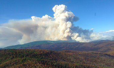
Remote Sensing of Wildfires
What you'll learn
Skip What you'll learn
What climate conditions lead to wildfires in Alaska
How wildfires are managed in Alaska
How fire impacts people, environment, ecosystems, and wildlife
How remote-sensing science works
How remote sensing is used for detecting wildfires, monitoring their spread, and assessing fire impacts
How remote sensing supports fire management decisions
How to locate wildfire remote-sensing data and geospatial products
Offered By:
AlaskaX
Course Duration:
4 Weeks
₹
7,284
add to cart
×
Cart Added Successfully!
×
Tnakyou For Email Subscribtion!
Chat with us
, powered by
LiveChat